
Photo: Espen Bergersen
Fram Centre
Monitoring whales with drones
May 31, 2019
Two researchers hunker by a fjord, oblivious to the magical blue of the January twilight. All their attention is focused on an unmanned aerial vehicle – a UAV. Gloveless despite the bitter cold, they manipulate the joystick and buttons on the remote control with numb fingers, preparing the drone for take-off.
By: Vibeke Os // UiT The Arctic University of Norway
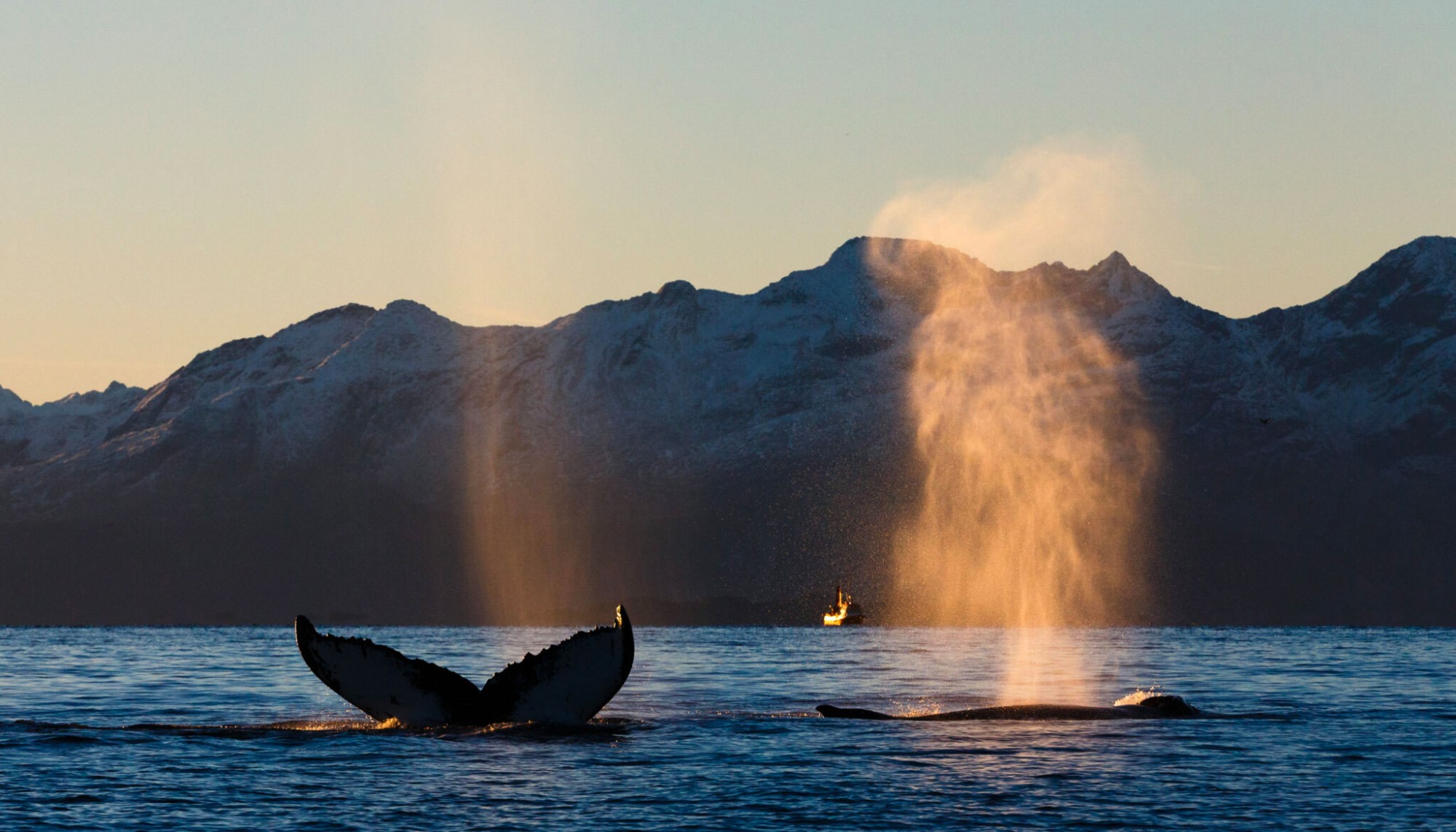
We are somewhere on the seaward coast of Kvaløya, west of Tromsø. The sea is calm but little waves lap the shore. Out in the semi-darkness of the fjord, whales can be heard emptying their huge lungs; killer whales and humpbacks are diving for herring not far from shore.
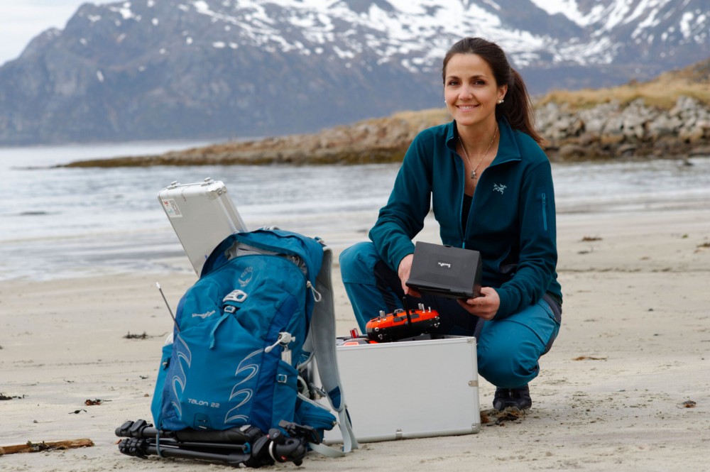
A couple kilometres from the two scientists with the drone, marine biologist Ana Sofia Aniceto sits shivering with cold high on a rocky promontory that juts out into the fjord. She stumbled up a twisting path by the light of her headlamp to find the optimal lookout. She needs to make use of what little daylight is available at this time of year. Her task is to spot the whales with her binoculars and measure the distance to those that appear on the water surface using her trusty geometer.
Predetermined route
The drone is controlled by experienced fingers. It is flying to the part of the fjord with the most activity; the camera on the drone’s underside snaps a picture every three seconds. The drone follows a predetermined route, flying in straight lines back and forth. Aniceto is nearby, monitoring the marine mammals’ movements with her binoculars and noting their coordinates as they move majestically through the fjord, pursuing an invisible shoal of herring.
Aniceto spent many days on the mountainside overlooking Kaldfjorden in the winter of 2014/2015.
The following spring, she analysed the coordinates she jotted down and correlated them with the images taken by the drone. Come summer, she and the two drone pilots will repeat the procedures near the island of Ryøya, in far more inviting weather and with unlimited access to daylight.
Supplementing existing methods
“Monitoring nature and wildlife is nothing new,” says Ana Sofia Aniceto, who works at Akvaplan-niva. She is involved in a project that tests and develops new technology to monitor marine animals. Satellites, weather balloons, land-based radar, aircraft and boats have been used to map wildlife in the past, but these methods have their limitations. Researchers are hoping to find a way to map marine animals that can supplement the existing methods.
ADVERTISEMENT
Thousands of images
“We correlate and compare the pictures of each animal with observations and distance measurements done from shore as part of our study. That allows us to chart the exact coordinates where an animal was located in the fjord and be certain that what we see in the image is a whale and not something completely different.”
Aniceto describes the image analysis as the most challenging and time-consuming part of the research task. “It took a long time,” she says with a smile. “But there’s definitely room for improvement,” she adds emphatically. No wonder: she analysed 4660 images manually and identified marine animals in 288 of them.
Identifying whales is difficult
Northern Norway is dark in winter, even in the middle of the day, and Ana Sofia Aniceto describes how darkness hampers image analysis. Other factors that influence their studies are waves and floating objects such as seaweed, logs and debris that form clusters in the ocean currents. Reflected sunlight also creates some uncertainty when reading images.
Aniceto thinks drones can be used in combination with other methods like acoustics and satellite imagery to great advantage.
Drones can do things the other methods cannot. Satellites cover a larger area, but they are useless in cloudy weather.
Acoustic methods can locate animals that vocalise, but not all whales vocalise all the time. Eventually, the researchers hope to develop digital tools that recognise whales in images – and they will use a more light-sensitive camera.
This story is originally published in the Fram Forum