New study reveals comprehensive buildup of nuclear missile test-ground at Novaya Zemlya
Russia is about to scale up its dangerous testing of the Burevestnik nuclear-powered cruise missile, according to a study of satellite images obtained by military analyst Tony Roper.
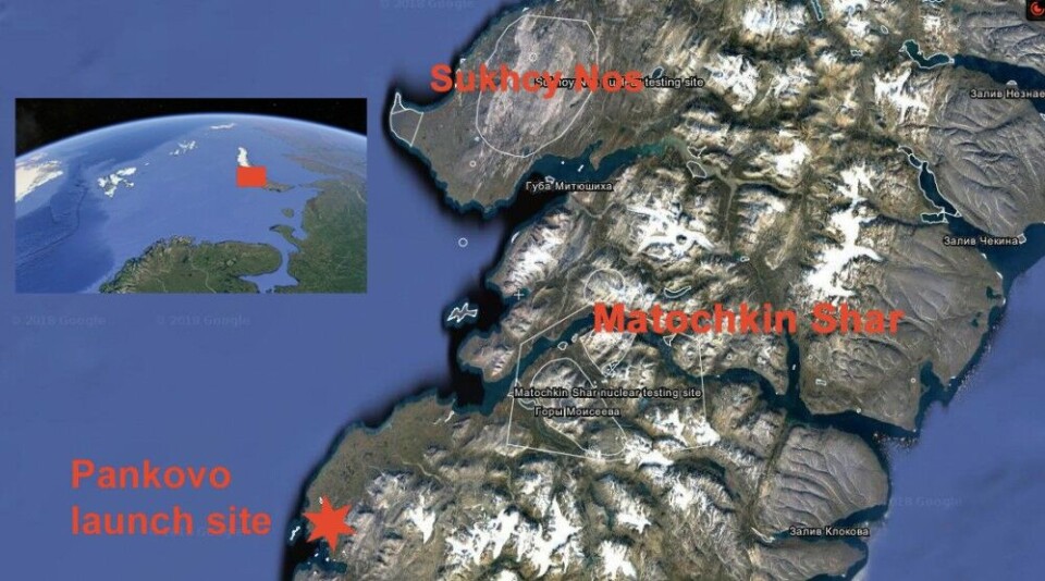
Few places on planet earth are surrounded by more secrecy than the remote military test ranges for nuclear material at Novaya Zemlya in the Arctic. Totally forbidden to visitors since the 1950ties as atmospheric and underground nuclear weapons tests were conducted till 1990. Since then, the polygon near the Matochkin Strait has facilitated subcritical nuclear tests.
A bit to the south is Pankovo, a missile launch site where Russia in November 2017 made at least one test flight of the Burevestnik, in the West known as the SSC-X-9 Skyfall.
It could as well be named ‘a flying Chernobyl’ as the missile is powered by a small nuclear reactor which is cooled by the outside air running through the uranium core, leaving behind radioactive isotopes as it is flying.
That is the reason tests of the weapon now take place at one of the world’s most remote locations, hundreds of kilometers from nearest civilian populations.
“Should anything go wrong, then it won’t be so noticeable,” said Tony Roper to the Barents Observer. He has for years studied satellite images from Novaya Zemlya. In recent months, his focus has especially been on developments at the Pankovo site.
This weekend, Roper obtained new satellite images that drove him to blow the whistle.
“It is definitely Burevestnik,” he said.
Tony Roper has published several of the satellite images on his online site, detailing the different infrastructure improvements made at the site this summer and autumn.
The size of the ongoing development is much more comprehensive than previous year’s container-based structures aimed at supporting the test launches of the nuclear-powered missile.
New infrastructure
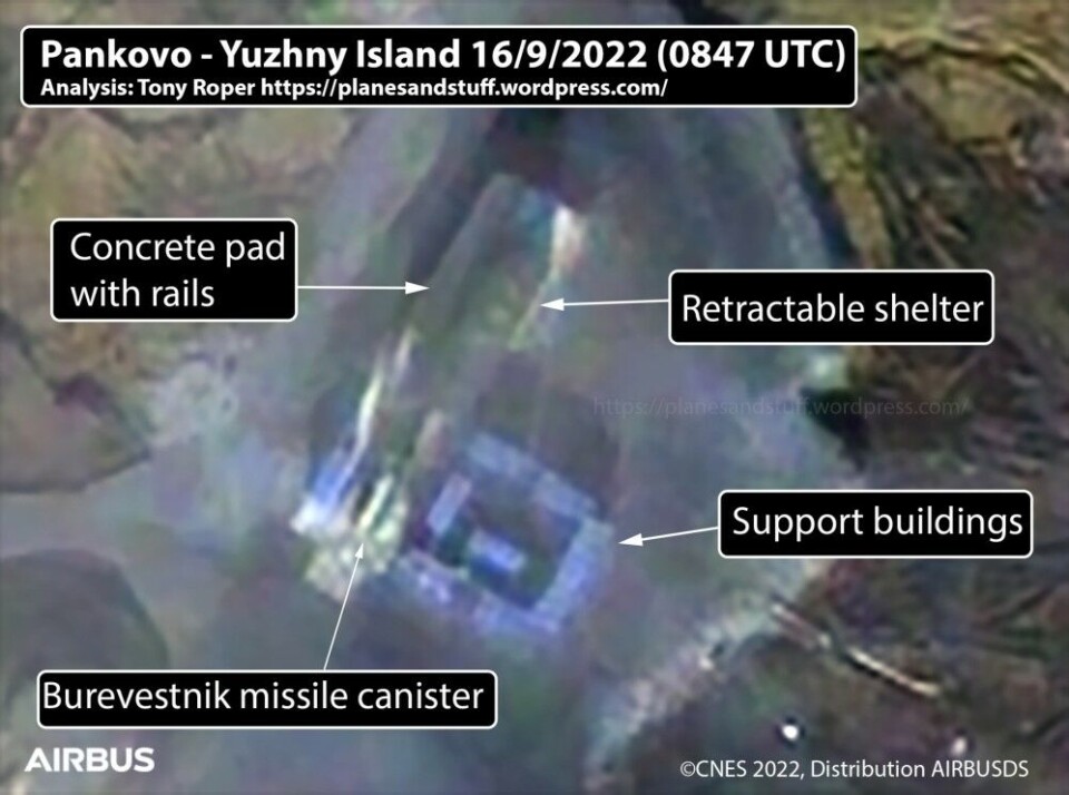
A new jetty is placed on the shore where equipment is landed from ships, the road is improved, helicopter pads are made, new buildings are erected, shelters and concrete pads with rails are assembled.
It is, however, Tony Roper’s latest findings from a space image taken by Airbus on September 16 that prove that the Burevestnik is actually present at Pankovo.
It was in March 2018 the work on developing Russia’s nuclear-powered cruise missile was made public to the outside world. Along with other weapons of mass destruction, President Vladimir Putin showed a video of the Burevestnik in his annual speech to the nation.
New blog - Burevestnik COULD be ready to test. New (and better) imagery corrects previous assessment!Bigger, and more, imagery in the bloghttps://t.co/y8irsIeSAw@MatchlessMan410 @MrSpaceball @The_Lookout_N @tom_bike @CovertShores @AtlandKristian @NilsenThomas pic.twitter.com/jrZqQ4DV6x
— Ropey (@Topol_MSS27)
Later the same year, U.S. intelligence sources reported about one of the missiles being lost at sea after a test in late 2017.
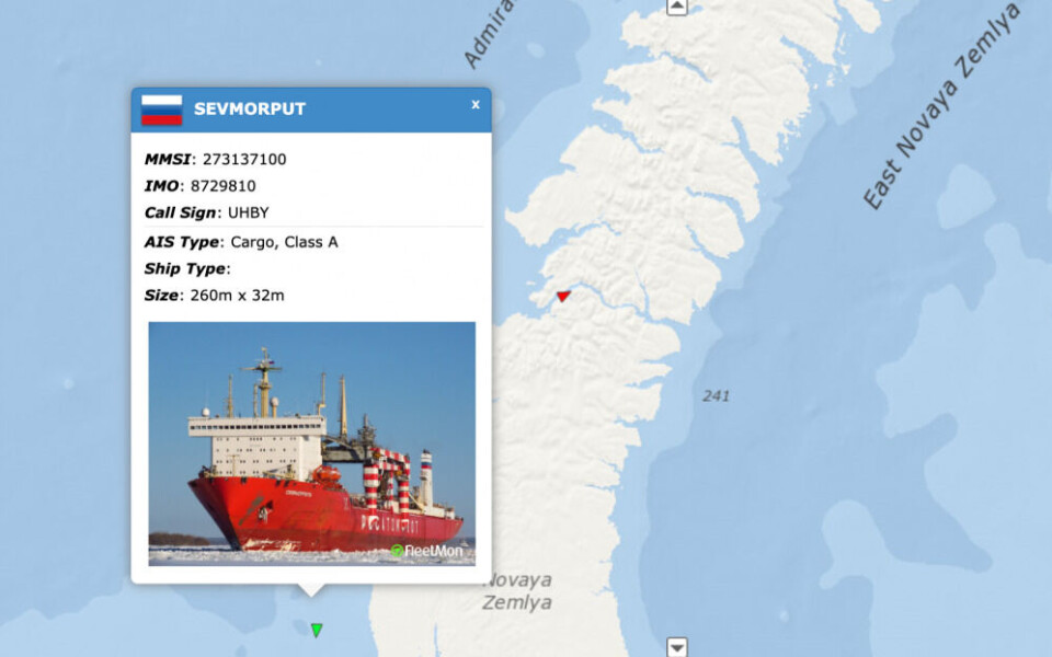
The building infrastructures to Pankovo are likely brought to shore from Rosatomflot’s nuclear-powered container ship “Sevmorput”, a vessel capable of floating out barges with containers towed to shores by smaller tugs in Arctic coastal areas where no harbor infrastructure is developed.
Rosatom in charge
Rosatomflot is a subsidiary of Rosatom, Russia’s state nuclear corporation also in charge of testing and developing the small nuclear reactors used with the Burevestnik missile.
The Barents Observer has followed AIS tracks of “Sevmorput” via the online exactEarth ShipView since August as the vessel has been shuttling back and forth between Murmansk, the waters just outside Pankovo and Rogachevo, the main military settlement on the southern shores in Novaya Zemlya.
By Sunday, September 18, “Sevmorput” is at anchor near Rogachevo.
The town is home to one of Russia’s upgraded air bases in the Arctic and also facilitates the polygon for sub-critical nuclear tests in the tunnels near Matochkin Strait. Helicopters flying personnel to Pankovo are based here, and it is likely that Rosatom’s specialists for developing and testing the Burevestnik missile are commuting to Rogachevo from mainland Russia.


