
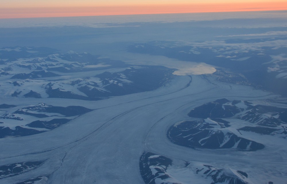
Dramatic temperature increase in Arctic archipelagos, among them Svalbard. Photo: Atle Staalesen
Warning bells jingle for December climate
The Christmas month starts with exceptional heat across major parts of the Arctic.

December 07, 2020
ADVERTISEMENT
Alarm bells are sounded over and again by climate experts, and the Christmas season is unlikely to be much different than the preceding months.
According to the Russian meteorological service Roshydromet, the extraordinary Arctic heat of November was on the first day of December followed by temperature records in a number of places across the Russian north.
In the island of Bely, north of the Yamal Peninsula, the winter month started with plus 1,1°C, the highest ever local registration for December 1. The same was the case in Dikson, the town on the Kara Sea coast, where the registration was minus 0,6 °C.
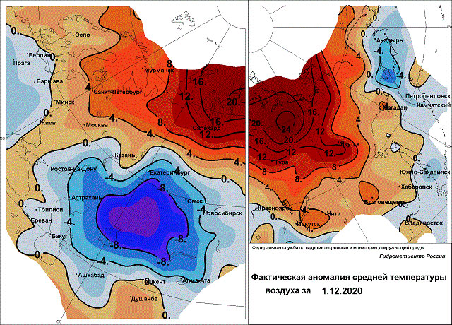
In Cape Chelyuskin, the northernmost point on the Russian mainland, the meteorologists measured minus 4,7°C, which is almost three degrees higher than the previous record for that day.
A temperature map presented by Roshydromet shows that parts of Arctic Siberia on the 1 December had a temperature deviation from normal of more than 20 degrees Celsius.
“These temperatures are very far from winter [cold] records of northern Siberia and Yakutia,” Roshydromet laconically explains.
According to the Russian state service, the average temperatures along major parts of the Russian Arctic coast are now for a long period between 10-15 °C above normal, and in November the deviation from normality in the region was set to 12 °C.
ADVERTISEMENT
The November temperatures follow a great number of months with abnormal heat across the whole Arctic.
In October, the average temperature for the whole circumpolar Arctic was 6,7°C higher than normal, and in the Russian Arctic archipelago of Severnaya Zemlya the average October temperature was as much as 10 °C above normal.
The melting of the Arctic sea-ice continues. According to the National Snow and Ice Data Center, the sea ice extent averaged for October 2020 was the lowest in the satellite record.
Sea-ice levels increased through November, but still ended up as second lowest in the satellite record for the month, just above 2016.
The November average extent of 8.99 million square kilometers was 1.71 million square kilometers below the 1981 to 2010 average, the Snow and Ice Data Center informs.
ADVERTISEMENT
Sections
Climate Crisis 


The Barents Observer Newsletter
After confirming you're a real person, you can write your email below and we include you to the subscription list.